
In Earth’s orbit
The extensive space interview with Tero Vihavainen, Secretary General of the Finnish Space Committee, has been published in the “Ydin” magazine 1/2024. Now we publish it also in SpaceFinland website. Step on a spaceship!
Editor-in-chief of the “Ydin” magazine Arja Alho visited the Ministry of Economic Affairs and Employment to talk to Chief Specialist Tero Vihavainen, who also is Secretary General of the Finnish Space Committee. Check out this discussion-based interview here.
In Earth’s orbit
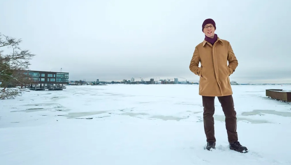
(text Arja Alho, photos Pekka Elomaa)
There's congestion and scrap in Earth's orbit. Satellites and their services are part of well-functioning everyday life but also military activities.
Arja: The first Sputnik was seen in the starry sky in 1957, space visitors have been celebrated, such as Juri Gagarin in 1961 or Apollo's moon flight in 1969. The cosmonaut and astronauts have been joined by taikonauts and many others. In the last few days there has been news from Japan, whose probe has landed on the moon.
Tero: It can be said that military intentions had a strong impact on space, research and innovation in the 1960s and 1970s. It was a superpower policy and a struggle for superpower.
Dual-use (i.e. dual-use items can be used for both civilian and military purposes) is now visible in the opposite direction. Innovations developed for civilian purposes may be used for military purposes, whereas military action was formerly more important.
Arja: In the 1980s Ronald Reagan spoke about the War of Stars and the inter-satellite War. However, international treaties have aimed to keep space in peaceful use.
Tero: In 1959, the UN General Assembly set up COPUOS Committee (Committee on Peaceful Uses of Outer Space), whose basic task is to discuss issues related to the use and research of space and to prepare draft agreements and resolutions.
International space law is based on five treaties concluded in the 1960s and 1970s, the most important of which is the Outer Space Treaty in 1967, to which Finland has also acceded. The other four agreements are the Rescue Agreement, the Liability Convention, the Registration Convention and the Moon Agreement.
Arja: The Outer Space Treaty is also the treaty prohibiting the orbit or celestial body of weapons of mass destruction. But it is clear that the tightening global political situation increases concern about the militarisation of outer space. Controlling space is one of the military doctrines.
Tero: COPUOS is active. Finland joined it in 2018. Unfortunately, the same applies to its work today as to international agreements in general: it is difficult. At the moment, there are 102 countries around the same table at COPUOS, including the United States, Russia and China.
Arja: The European Space Agency ESA started research and development activities in 1975. The latest EU space programme was decided in 2021, it was updated in 2023, and in Finland the Act on Space Activities entered into force in 2018.
Tero: Currently, space systems are widely used in everyday life. They may be disturbed, natural or intentionally caused, which may further affect the functioning of society.
For security of supply, space services must be secured during disruptions. For this reason, the European Commission published in 2023 a Space Strategy for Security and Defence, which also aims to ensure the continuity of society's everyday functions.
In Finland, the Space Act was considered necessary when we were about to become a space state. The first Finnish satellite launched into space was a university satellite launched in 2017 and the first commercial satellite launched in 2018. The state is responsible for national space activities, even if the operator is from the private sector. Currently, there are 25 Finnish satellites in space, two have already reached the end of their life cycle and they have been removed from Earth's orbit.
In previous decades, space was mainly operated by state actors, as it was very expensive to build satellites and take them to Earth’s orbit. Technological progress has, however, led to a significant decrease in the size and price of equipment. This has also enabled access to space for smaller states and private sector actors. Space is now more than ever accessible to everyone.
On the other hand, the democratisation of space activities is a good thing, but the development has two aspects: the large number of actors poses challenges to finding common ground rules for the sustainable use of space. Last autumn, we have produced a series of articles on space ethics from different perspectives on our SpaceFinland.fi website.
Arja: How is space technology visible in our everyday lives?
Tero: Space activities can be divided into five parts. The first is remote sensing. There Earth orbiting satellites measure and observe activities on Earth and in the atmosphere. The second is navigation. Satellites send signals on the basis of which the end user receiver, such as a mobile phone, can calculate its own location. The third area is telecommunications, where satellites are used to complement or replace terrestrial information networks.
The fourth is research, such as manned flights or launching probes. These provide unique conditions for scientific work that cannot be achieved on Earth. The fifth is observing space from Earth, for example, such as observing other celestial bodies, objects in Earth’s orbit or space weather and solar activity.
Arja: Could you give practical examples of how to utilise the collected data?
Tero: For example, in agriculture and forestry remote sensing provides information on forest growth or the need for fertilisation in fields. We can take targeted measures to save money and nature. Weather forecasts are a big issue, as are disaster monitoring, for example, in earthquake and flood areas.
Monitoring carried out on the ground can be used to investigate point-like situations, but satellites can be used to carry out monitoring globally and to obtain extensive and long-term information on climate change, for example. It is important for Finland to investigate the ice situation and steer icebreaking.
In addition to these everyday uses, there are also applications related to intelligence and security for space services.
Arja: The examples you described are like a databank for implementing the green transition. What about the others?
Tero: Satellite navigation is very close to me and integrated in a wide range of functions in society. We know car navigators and mobile phone map applications best.
Transport and logistics services rely on satellite navigation to make goods move smoothly. Air traffic control can control air traffic in a way that saves fuel and does not rotate the planes in the air awaiting landing permission. Similarly, the approach of cargo ships to unload cargo to ports can be optimised. In road transport, on the other hand, benefits can be given to public transport, for example. Location data is also important for rescue services and authorities in general, such as customs and border guards. It is particularly useful to create situational awareness and manage events.
Television and radio broadcasts are the most traditional and still largest application area in satellite telecommunications. Today, broadband can also be routed via satellites, similarly to the Internet, in sparsely populated areas, at sea or in the air, i.e. areas where the mobile phone network does not function. In addition to civilian use, the applications also have security use. For example, if the terrestrial infrastructure has been destroyed in disaster areas, a communication connection via satellites can be built in the area.
Space weather and monitoring of the activity of the sun are important in space observations. Solar outbursts can cause energy shocks to Earth that can cause momentary disturbances or failures in electrical systems. In Finland, this is an important research area because due to the characteristics of the country's magnetic field, space weather phenomena and their impacts are stronger in northern areas.
Then there are the space objects...
Arja: … and an incredibly large amount of space debris. I read that more than 10,000 satellites have been launched into orbits, of which 1,200 were functional a couple of years ago, while the rest were carcasses or scrap. An estimated one million pieces are less than 10 cm in length but more than 1 cent in size. There are 130 million smaller ones.
Tero: Space debris is a big problem. We can still live with it, but if the situation gets worse, the scrap may even prevent the use of certain orbits. When a thumb-sized nut hits the satellite at an hourly rate of about 25,000 kilometres, it breaks down and, at the same time, new, small and larger fragments begin to running round in space.
It would be very important for all actors to commit to the principles of sustainable use of space. It is essential that when space objects are launched, their activities are planned so that they are automatically removed from orbit at the end of their life cycle.
In the future, attempts can also be made to remove inoperable objects, but cleaning Earth's orbits from space debris is not easy. For example, it could be possible to push an object from orbit, but in addition to technical challenges, it also faces questions related to international agreements and justice. Everyone understands the need to reduce debris in near space, but making binding agreements is challenging.
Arja: The European Union's Galileo positioning system is managed by civilians, unlike military-led GPS. What is the European space structure like?
Tero: The content of the programme is defined in the EU Space Programme Regulation (EU 2021/696). Its implementation is the responsibility of the European Commission, supported by two actors: the European Space Agency EUSPA and the European Space Agency ESA. EUSPA operates and maintains existing systems when ESA's role is to research and development of systems. The funding for the space programme comes from the EU budget.
The EU Space Programme has four components: 1) Galileo and EGNOS satellite navigation systems, 2) Copernicus Earth observation system, 3) GOVSATCOM data communication system for Member State authorities and 4) SST system for observing Earth’s orbit space objects. The EU Space Programme is fully maintained and managed by civilian authorities.
Arja: Is it reasonable that different countries have created their own systems? How much cooperation is there?
Tero: Operation and communication of all satellites are based on radio communication. The allocation of radio frequencies used for space activities is agreed globally within the framework of the International Telecommunications Union ITU. There are 193 Member States involved.
For example, the European Galileo navigation system has been designed to be compatible with American GPS, Chinese BeiDou and Russian GLONASS. Receivers, such as mobile phones, can typically use all these systems in their positioning applications. This creates certain stability in everyday life when no one is dependent on just one system.
Europeans are pioneers in remote sensing. The Copernicus Earth observation system produces high-quality information on, for example, the state of waters and carbon dioxide emissions. The collected observation data are openly and free of charge available to everyone, also outside Europe.
Arja: You are Senior Specialist in space affairs at the Ministry of Economic Affairs and Employment and Secretary General of the Finnish Space Committee. What does the Space Committee do?
Tero: Finland has decentralised space administration. The Space Committee steers the practical implementation of the national space strategy, develops the space operating environment and coordinates cooperation between administrative branches. It also coordinates Finland's international cooperation in space issues and promotes the visibility and communication of the space sector.
Arja: How is privacy protected in satellite data?
Tero: As such, satellite navigation or telecommunications cannot be used to monitor individuals – they can only be used to transmit signals to Earth, not back.
If, for example, positioning data is to be distributed from the receiver to others, it must be done, for example, via a mobile phone network. In satellite images taken from Earth there can be seen individual buildings, but the accuracy of the Copernicus system, for example, is far from sufficient to identify individual people or vehicles. The protection of privacy is, of course, a constant topic of discussion.
Arja: Starry sky should be a place of peace. What do you think the future looks like?
Tero: Weaponising space would be very expensive. It is, of course, terrible to say that, but it is cheaper and more efficient to build weapons systems on the ground. Satellites play a role in intelligence and telecommunications, but they are more support activities for military activities. I don't think it's likely that space will become militarised.
Arja: Scifi and threatening speeches are frightening. But if satellites or other space objects are destroyed for military purposes, only more space debris will be generated and it will always retaliate against itself. Nuts or a strip of paint can defeat conquest efforts and weapons can only degrade orbit debris.
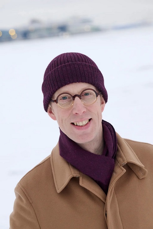
Tero Vihavainen
|


