
Satellite Navigation Systems
Global Navigation Satellite Systems (GNSS) and their augmentation systems together enable countless uses and services in contexts making use of location, navigation and very accurate time data.
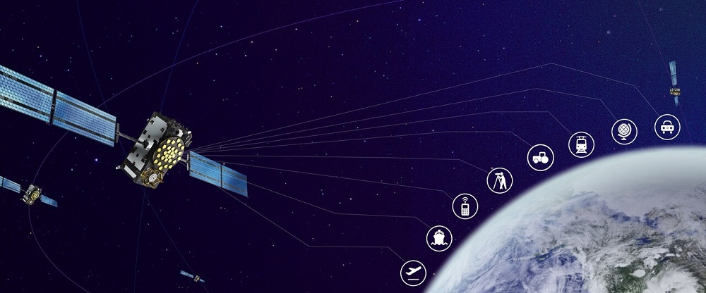
Photo: ©European Agency for the Space Programme (EUSPA)
All satellite navigation systems share the same operating principle: the system’s satellites transmit radio signals and the user’s satellite navigation receiver then uses the structure and message content of those signals to compute the user’s location and the accurate time. There are currently four GNSSs that are globally available and openly accessible by all:
In addition India (IRNSS) and Japan (QZSS) are developing their own regionally operational satellite navigation systems. The opportunity to use multiple GNSSs at the same time increases the number of available satellites many times over compared with a situation where only one system is used. This improves the accuracy of deter-mining the location and time, particularly in more challenging conditions such as street canyons and forests featuring obstacles to satellite signal reception.
Use of GNSS systems
GNSSs are part of our everyday life, even if we are not always aware of their existence. Accurate location and time data is an important factor not only in many consumer applications but also in many key functions of society.
Cumulative revenue generated by consumer GNSS applications is estimated to total around EUR 960 billion in 2019–2029, accounting for around 38% of the global GNSS market. Most of consumer segment devices with a GNSS receiver are mobile phones. In the years ahead, the market for wearables, such as sport watches, and various tracking devices is projected to grow significantly.
In addition to access to location data, important features of consumer segment devices include low power consumption and quick connectivity to location data when the device is turned on. GNSS not working in-doors is a clear problem.
Transport systems are the most significant deployers of satellite positioning systems. Fields of application can be divided roughly into value-added services (such as route navigation) and safety- and security-critical applications (such as traffic control systems).
In road transport, an everyday GNSS application is route navigation, which is employed by all user groups from private individuals to professional drivers and the authorities. Smart transport applications are evolving rapidly. In addition to autonomous driving, many systems assisting the driver and traffic monitoring applications rely on GNSS-based location data. GNSS location data is also exploited in transport logistics in freight and fleet tracking applications. Road wear can also be estimated by monitoring traffic volumes and heavy-duty transport.
In aviation and air navigation services, GNSSs are utilised in versatile ways, for purposes such as arranging optimal arrival sequences and landing routes. Aerodrome operators and providers of air traffic management/air navigation services (ATM/ANS) must, however, take the necessary measures to ensure that they remain capable of providing their services through other means in case of disruptions of satellite navigation.
Unmanned aviation is undergoing strong growth, and the market is expected to generate major commercial benefits for many sectors of the economy. Availability of accurate location and altitude data is vital in drone operations. To provide this data, GNSSs can be augmented with RTK methods and sensor-based inertial navigation.
In rail transport, satellite positioning is currently used in Finland to provide train running information. Most of the trains are currently equipped with GNSS trackers that transmit location data to the timetable system. Track inspection services and railway maintenance feature data also make use of GNSS positioning.
In maritime transport, vessel positioning is based on GNSSs, particularly on the high seas. In coastal and inland navigation, parallel methods such as radar systems are also employed to provide location data. Location data is used in maritime transport not only for vessels’ own route navigation but also for monitoring the situational picture of maritime transport and for maritime traffic control.
There are numerous potential uses for GNSS applications in logistics, including the real-time tracking of fleet location. When fleet location is known, delivery and routing plans can be changed very rapidly if necessary. Consignment- and package-specific tracking is also possible in real time. Timely deliveries help to reduce the need for interim storage, increase production process efficiency and improve customer service. In logistics, predictability and reliability play a key role. These call for not just data on one’s own location but also real-time data on traffic congestion and disruptions that is often based on positioning.
Forest industry roundwood transport is largely based on satellite positioning. When the forwarder brings logs from the forest to a roadside landing, the operator uses satellite positioning to mark the location of the stacks electronically. Precise location data is also needed to control the operation of forestry machinery on logging sites: identifying unit boundaries and following them automatically using GNSS increases work efficiency significantly.
In earthworks, the operation of machinery is automated by 3D-modelling the site, such as a grade-separated junction, in the design phase and entering the model in the work management system. On the construction site, machinery is assisted in filling work by controlling their operation based on location data and site modelling. GNSS-based machine control increases work efficiency significantly compared with manual surveying methods.
The operation of agricultural machinery can be assisted on the basis of location data: for example, fertiliser dose allocation can be optimised automatically by tracking the movements of the tractor in the field. In the same way, information on the site’s growth data and conditions can be collected on the basis of a tractor-mounted measurement system and GNSS location data. The autonomous mobility of agricultural machinery is also projected to become more common in the years ahead.
All data with location as one of its attributes is spatial data, with location expressed using, for example, an address, name of an area (such as a municipality or a state), code (such as a property identifier) or coordinates. Spatial data includes data on buildings, facilities, municipalities, nature reserves, weather, offences, accidents, radio signal strength, mobile phone location data and transport infrastructure as well as statistical data, among others. Thanks to its location attribute, spatial data can be efficiently used and combined by means of various geographic information system (GIS) methods for many types of analyses, plans and maps.
GNSSs are among the most significant sources for providing location data in various spatial data applications.
Many functions that are critical for security of supply, such as telecommunications networks, energy transmission systems and banking and payment systems also require accurate time synchronisation between functional units.
Accurate time synchronisation can be implemented using time data provided by various signalling systems, such as fibre-optic networks, atomic clocks or GNSSs. The benefits of GNSS time data are highlighted particularly in telecommunications network applications where continuously increasing data transmission speeds require a higher level of time synchronisation between network components.
Emergency call systems
In rescue services, key location data needs are seen in locating accident scenes and guiding rescue equipment to the scenes. The location of the scene of an accident is traditionally communicated to the rescue coordination centre (RCC) during the emergency call. Unfortunately, when conveyed orally, the location information is often inaccurate or even incorrect, which makes it difficult to guide the help to the right spot. Emergency call applications that automatically transmit location information are becoming more common. For example, the 112 application used in Finland transmits location information from the GNSS systems to the rescue authorities during the call.
There are two major EU legislation projects underway to support the increased use of such applications:
- In 2018, the eCall system became mandatory in new vehicles within the EU. The system provides the location and movement data of vehicles involved in accidents to the rescue authorities.
- From March 2022 onwards, the EU regulation C/2018/8383 will require mobile phones sold to the EU to support the E112 emergency calls service, where, during an ordinary 112 emergency call, caller information from GNSS is transferred automatically to the rescue authority.
Galileo Support to Search and Rescue Service (SAR/Galileo)
The European Galileo system satellites are able to provide support to the international COSPAS-SARSAT emergency signal system. With the help of this system, using an emergency locator radio beacon, persons, aircraft or vessels in distress can send an alert signal to authorities. In Finland, the Border Guard is the authority responsible for COSPAS-SARSAT cooperation.
Authorities make use of GNSS location data in leadership and command systems for the formation of situational picture and situational awareness and for the coordination of mobile units. Satellite navigation is also exploited in the same way as in the private sector for route navigation of various modes of mobility and for time synchronisation of measurement and control systems. Finnish authorities using these systems include the rescue services, social services, police, Border Guard, Customs, national defence as well as transport system actors, government environmental and natural resources actors, the Finnish Meteorological Institute (FMI), Flood Centre, Finnish Broadcasting Company (Yle) and municipalities.
The most significant difference between the use of GNSS by the authorities and by private sector applications is the requirement of operational continuity in exceptional circumstances, too. This is why the Government’s Ministerial Committee on Economic Policy decided in November 2020 that Finland will nationally deploy the Public Regulated Service (PRS) of the European Galileo satellite navigation system during 2024.
Augmentation systems for GNSSs
Systems to verify and specify GNSS location data have been implemented using different techniques. They can be used for verifying the correctness of location data in safety-critical areas, such as aviation or applications requiring very accurate location data.
Satellite Based Augmentation Systems (SBAS) have been developed to improve the performance of satellite navigation by means of ground stations, computing centres and satellites broadcasting correction data. These provide correction and reliability data for positioning that is typically transmitted to users via satellites in geostationary orbit (GEO). The system used in Europe is the European Geostationary Navigation Overlay Service (EGNOS), the current version of which is the SBAS used for GPS.
The EGNOS service was deployed in 2009. The 39 EGNOS Ranging Integrity Monitoring Stations (RIMS) observe GNSS signals and provide correction and reliability data within Europe. The data is broadcast to users via three geostationary satellites or, alternatively, over the internet using the EGNOS Data Access Service (EDAS). In Finland, geostationary satellites are visible at low elevation angles on the southern horizon, making it difficult to receive the support data.
EGNOS provides three services: the Open Service (OS), the Safety of Life Service (SoL) and the EGNOS Data Access Service (EDAS).
Differential Global Navigation Satellite System (DGNSS) services are based on precisely known reference station locations that can be used to determine how much GNSS satellite distance observations deviate from actual distances. Called DGNSS corrections, these differences in distance are then delivered to users via the data network. The user’s receiver first corrects the distances it has recorded on the basis of these differential corrections and then calculates its position in the normal way. DGNSS corrections can be used in real time.
One examples of DGNSS services is the FINPOS service of the National Land Survey of Finland (NLS).
The highest-accuracy positioning and navigation applications use measurements of the phase of the signal’s carrier wave as well as regional support services such as Real Time Kinematic (RTK) and Network Real Time Kinematic (NRTK).
Precise Point Positioning (PPP) techniques have evolved very rapidly. With the cost of multi-system reception and receivers decreasing, PPP can challenge traditional Differential Global Navigation Satellite System (DGNSS) technology and offer navigation accuracy at the decimetre level in real time. Several companies provide correction services via geostationary satellites.
Once deployed, the open-access and free-of-charge High Accuracy Service (HAS), based on PPP technology, will provide global positioning accuracy of 20 centimetres.
Read more:
Accuracy of GNSS local data
Galileo – European Union's satellite navigation system
More information: gnss(at)traficom.fi