Protection of the Baltic Sea from outer space: Satellite-based monitoring of water bodies also involves citizens
The Baltic Sea Day launched by the John Nurminen Foundation was celebrated for the fourth time on 31 August 2023. Space activities are also linked to the protection of the Baltic Sea: Jenni Attila, Chief Researcher at the Finnish Environment Institute (SYKE), talks about the role of satellite observations in marine protection and citizens' opportunities for participation.
What is the significance of satellite-based monitoring in promoting the Baltic Sea protection objectives?
Jenni Attila: Satellite observations have the advantage of obtaining comprehensive and up-to-date information from large areas that is straightforward to combine with other observations. The knowledge base is quite unique, and we cannot find observations from any other observation sources in every gulf, estuary and extensive open sea areas along the coast of Finland. We can combine them with other observations and thus produce long-term assessments of the state of the Baltic Sea and its changes.
How is satellite-based Baltic Sea monitoring realised in Finland?
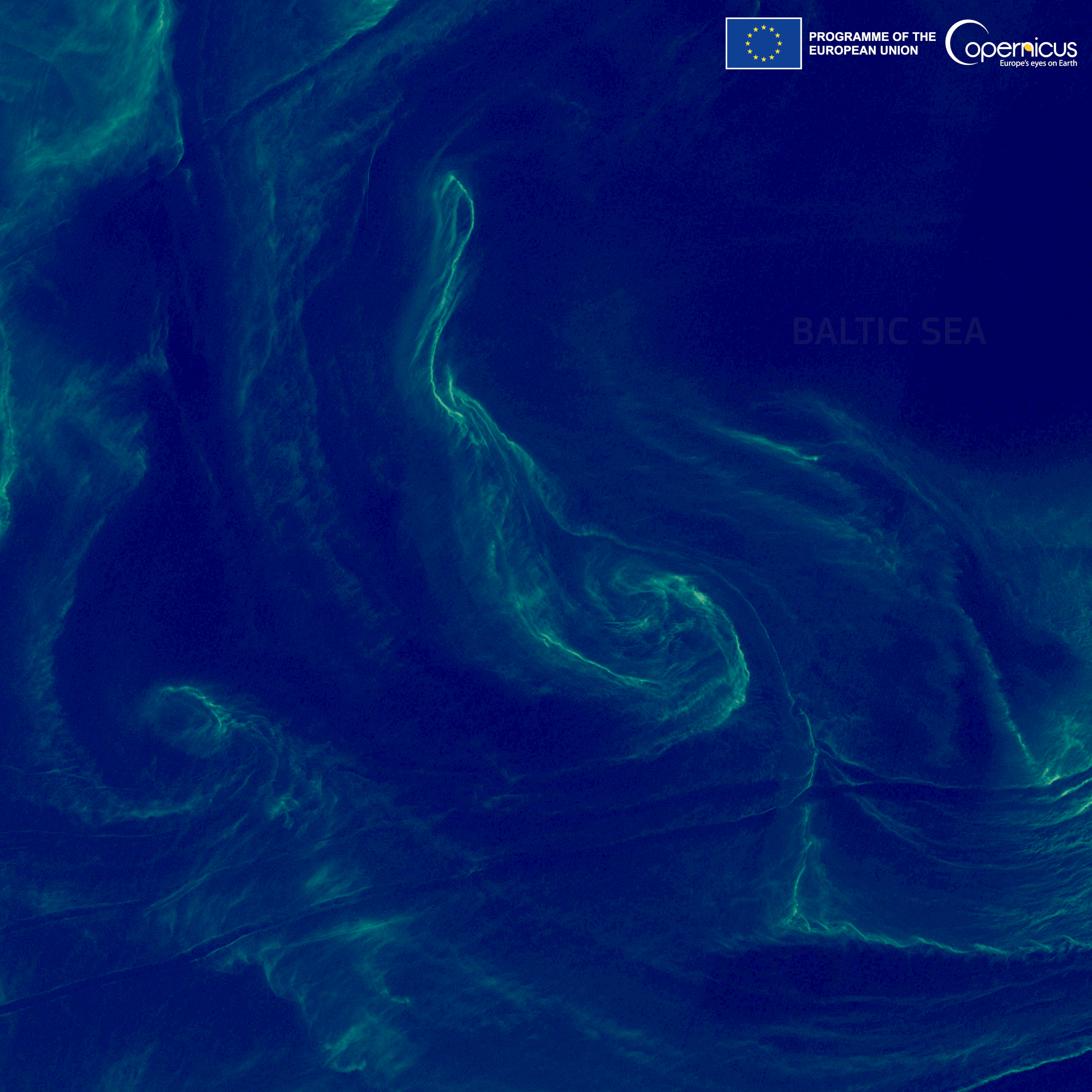
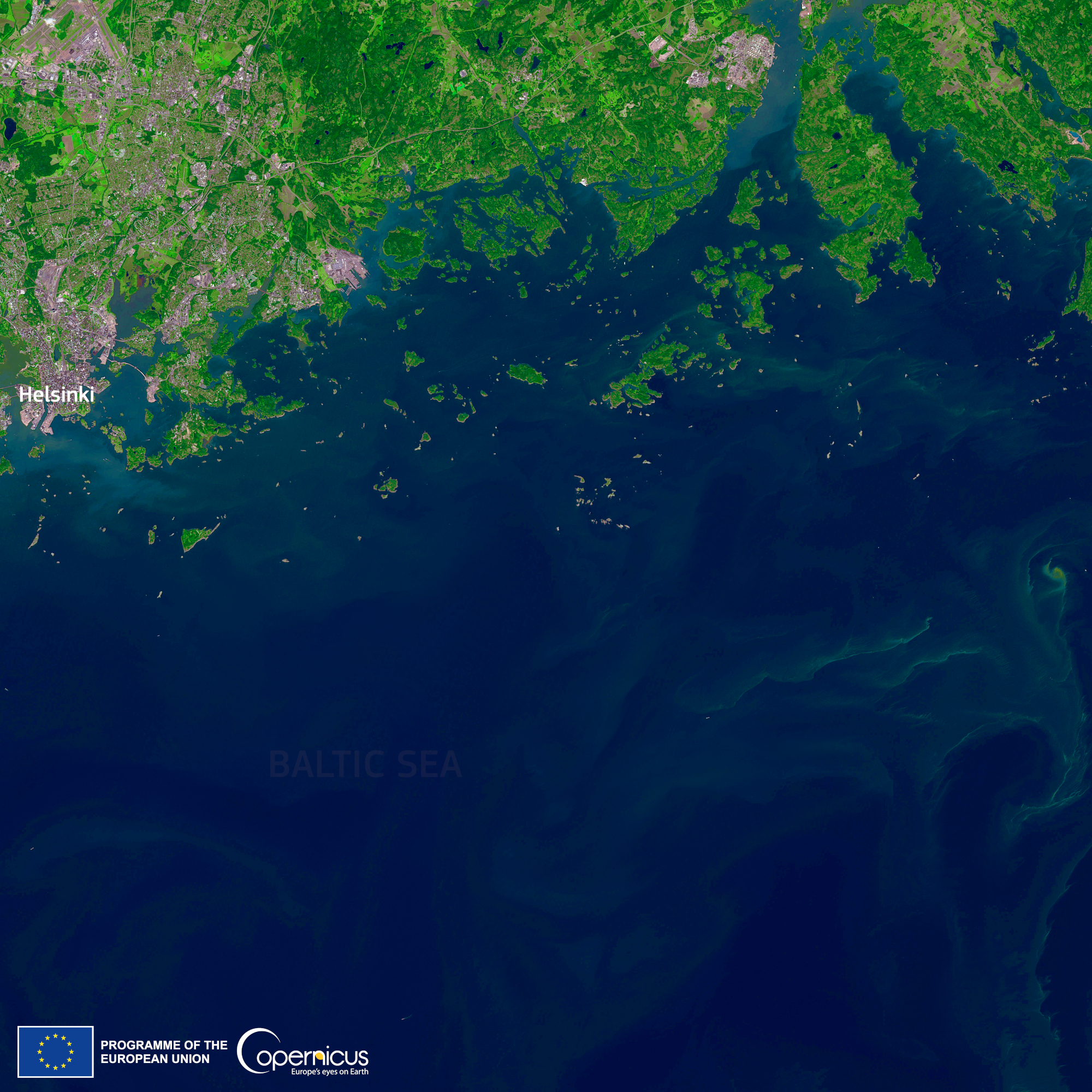
Satellite observations are used in the Baltic Sea region to monitor the amount of algae, the impact areas of coastal river waters, nutrients, darkness of waters and water temperature at the Finnish Environment Institute. All these observations are related to our assessment of the current state of the Baltic Sea and its impact on people. Eutrophication is a key issue for us, and it also involves the impact of climate change on the Baltic Sea and, among other things, the viability of coastal species. We accumulate data for assessing changes in the coming years and also compare the current state with observations made in previous years. In addition to SYKE, the Finnish Meteorological Institute, for example, monitors the ice situation and waves from satellite observations.
To which levels are observation data distributed?
We share observation data openly through SYKE's Satellite Observation Service Tarkka +, in weekly blue-green algae reviews. The observations are also followed by the media and citizens. In addition, we will work on more detailed information for experts, which will be utilised in the status assessments required by the directives. These include the water Framework Directive and the Baltic Sea holistic status assessment (HOLAS III) coordinated by HELCOM. For this need, we mainly accumulate data as statistical data calculated from satellite observations with automatic data production.
In connection with satellite-based Baltic Sea monitoring, has Finland participated in European Space Agency’s or EU-level projects?
We are constantly running several ESA and EU projects. They provide us with a good opportunity to promote cooperation and common goals in the Baltic Sea region, for example, but also in the entire EU region. ESA has a “Baltic+ Programme” focusing especially on the use of satellite observations in the Baltic Sea, which has been a very good tool for promoting development work and service production related to satellite observations and modelling related to the state of the Baltic Sea.
How can citizens participate in monitoring and protecting the Baltic Sea?
Observations by citizens are a good tool. Many citizens also follow the Baltic Sea through satellite observations, and this information is now widely combined. Observations by citizens are valuable information for us, which often coincides well with satellite observations. In addition, the water restoration network, for example, can be used to participate in the activities of local water restoration associations, which have carried out a great deal of concrete restoration work.
Take part in the monitoring of water bodies:
- https://tarkka.syke.fi/eo-tarkka/?ver=0&lang=en
- https://scihub.copernicus.eu/
- https://itameripaiva.fi/en/
- https://www.marinefinland.fi/en-US