
A report recently published by the Finnish Geospatial Research Institute recommends new measures to protect against interference

According to a report prepared by the Finnish Geospatial Research Institute, to ensure reliable positioning, a service that provides up-to-date situational awareness is necessary along with research to develop backup systems and protection for satellite positioning.
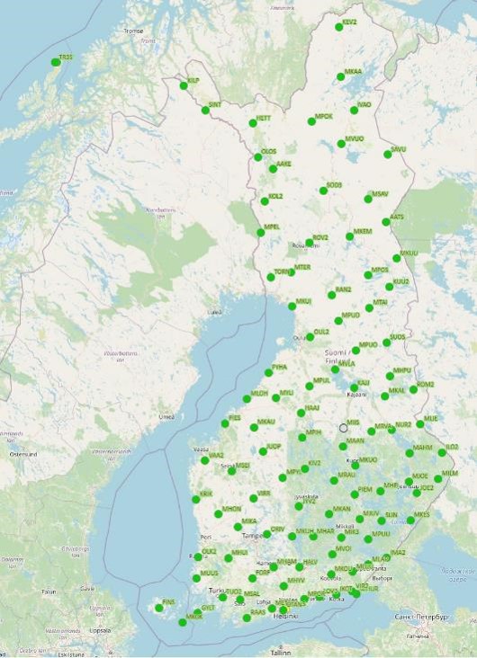
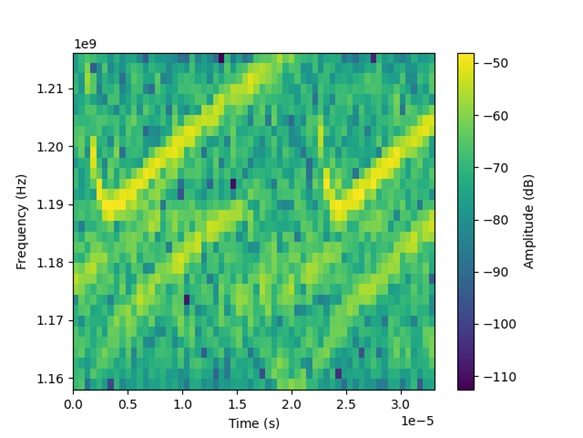
Interference with satellite positioning (Global Navigation Satellite Systems – GNSS) in Finland has increased significantly since 2022. It causes disruptions to aviation and maritime traffic, rescue services, as well as stock exchanges and telecommunications networks. The interference mostly affects flight altitudes, but it has also been experienced at lower levels, such as over the Baltic Sea, and occasionally at the National Land Survey’s ground stations (see https://gnss-finland.nls.fi/). Currently, possibilities for addressing GNSS interference in Finland are limited, as the interference signal mainly originates from behind the Eastern border.
The Finnish Geospatial Research Institute (FGI) of the National Land Survey of Finland (NLS) carried out a comprehensive expert study on the topic titled “GNSS security and resilience in Eastern Finland”. The study presents methods to improve the security and resilience of GNSS, particularly from the aviation perspective, as well as alternative positioning methods. It examines both manned and unmanned aviation in the development of GNSS interference mitigation solutions.
Need for research and situational awareness of the GNSS signal
The study emphasizes the need to improve the situational awareness related to GNSS signal quality and calls for further research. It also recommends launching a strategic research program in Finland to promote the development of operational concepts and architectures for navigation resilience. One of the conclusions is that current aviation navigation systems, such as DME, radar, and multilateration methods, remain essential for operational continuity.
Although receiver robustness can be improved through multi-constellation, multi-frequency solutions and advanced antenna technologies (such as Controlled reception pattern antennas (CRPA)), these may not be sufficient if interference is strong enough. Further research is particularly needed because hybrid navigation methods—combining inertial measurement, cameras, LiDAR, and terrain- or map-based methods—can provide reliable positioning in GNSS-denied environment. These methods should be developed into interoperable and standardized solutions. In the future, low Earth orbit (LEO) satellite positioning systems, such as the EU’s Celeste, as well as AI-based sensor fusion, are expected to further improve the reliability of positioning, navigation, and timing (PNT).
In addition to PNT technologies, Finland also needs real-time situational awareness and monitoring of the GNSS signal integrity. This could be implemented as a service showing whether positioning signals are available. Information on GNSS signal reliability is also essential for receiver resilience, and therefore the latest commercially available receivers already monitor the signal quality.
The study was conducted for the Logistics and Maritime Research Unit of South-Eastern Finland University of Applied Sciences (Xamk) as part of the project “Growth from Modern Aviation to Eastern Finland.” The project is co-funded by the EU and also financed by companies and municipalities. GNSS interference is particularly common in Eastern Finland, where it causes disruptions to aviation and business activities, but the results are applicable to other regions experiencing GNSS interference as well. In addition, the increasing use of drones in airspace highlights the need for reliable positioning and improved operational models.
The report is freely available here
National Land Survey of Finland's press release on the subject
Lisätiedot:
About the report:
Professor Sanna Kaasalainen, Director of the Navigation and Positioning Department of the Finnish Geospatial Research Institute (FGI), tel.
+358 50 369 6806
About the project:
Project Manager Eija Joro, South-Eastern Finland University of Applied Sciences Ltd/Logistics and Maritime Research Unit, tel. +358 50 311 2237


